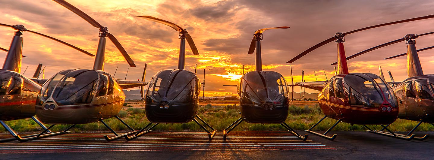
Precision Aerial Surveys and Media Production in Sacramento
Strategic Aerial Perspective
For any demanding aerial survey requirement across California, including specialized magnetometer and electromagnetic surveys, LiDAR data acquisition, and precise GIS mapping, Sacramento Helicopter Charters provides unparalleled capabilities. Helicopters excel in these operations due to their inherent ability to execute low-altitude flight paths and sustained hover, critical for high-resolution data collection. Furthermore, we facilitate advanced aerial filming and photography services, offering access to cutting-edge cinematography technology and custom modifications like door removal for handheld precision. Our extensive options ensure that whether your project demands detailed geological insight over the Sierra Nevada or cinematic excellence above the San Joaquin Valley, we deliver tailored solutions to achieve your objectives.
Aerial
Surveys
LiDAR, GIS Maps, FLIR, HD Video & More
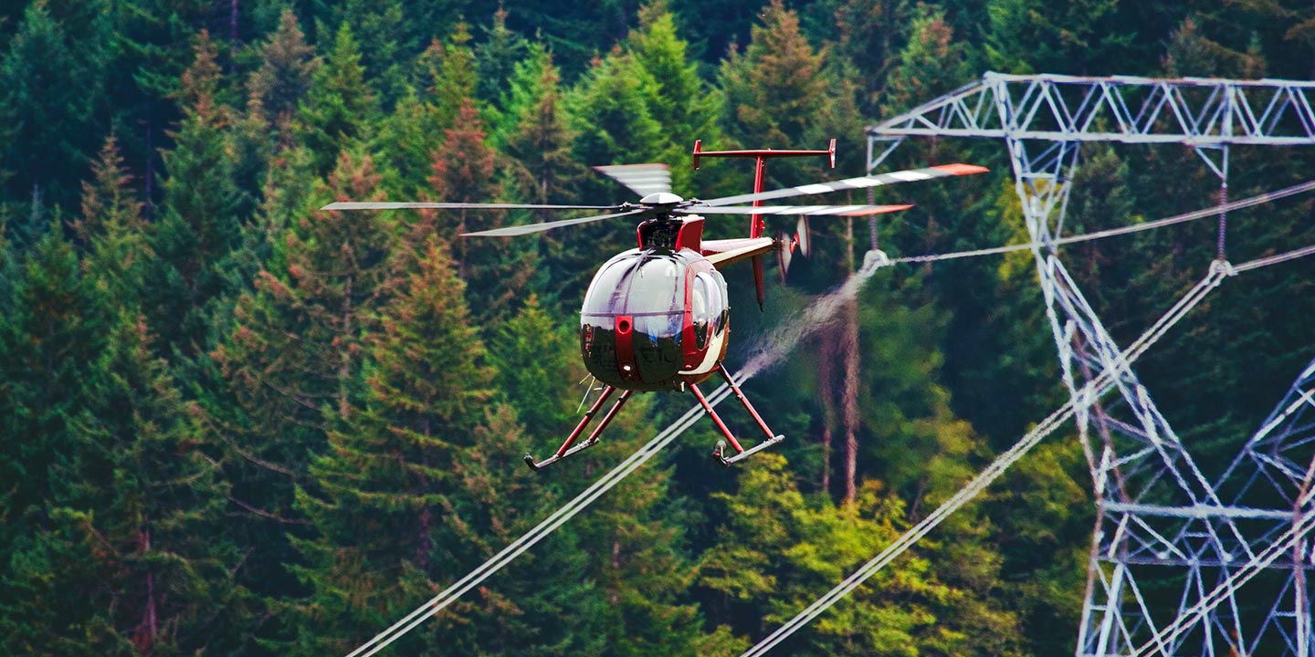
For critical infrastructure management, Sacramento Helicopter Charters delivers specialized aerial support. We provide comprehensive solutions for pipeline integrity surveys, right-of-way inspections, and transmission line patrols across California. Access to the optimal aircraft, equipped with advanced sensor technology, ensures precise data acquisition and efficient execution of your vital asset monitoring projects.
High Tech Results
The Top Pilots in California, Today's Technology... Maximum Results.
Call 1-866-826-4826 Now!
Sacramento Helicopter Charters provides the tools needed to complete your land surveys, utilizing the right equipment to provide the aerial photos that are often needed.
An effective aerial survey transforms complex right-of-way and site inspections, detailed topographical data acquisition, and high-definition imaging for commercial projects into streamlined operations. Helicopter-based surveys offer an unparalleled vantage point over California's varied terrain, enabling precise detection of pipeline leaks, identification of transmission line anomalies, and comprehensive visual documentation of properties in regions from the Central Valley to the coastal ranges. Sacramento Helicopter Charters specializes in developing bespoke photographic and remote sensing operations, meticulously custom-fitted to maximize technical precision, financial efficiency, and deliver superior actionable results for your enterprise.
The inherent operational characteristics of helicopters make them the superior platform for precision aerial surveying. Unlike fixed-wing aircraft, which are subject to FAA minimum altitude restrictions, helicopters can operate at significantly lower airspeeds and altitudes, including sustained hover capabilities. This agility is critical for acquiring high-resolution data and conducting detailed visual inspections across challenging terrains, such as those found in California's diverse landscapes. This unique flight envelope grants engineers unparalleled access and an otherwise unattainable perspective into troublesome or hazardous zones, enhancing both data quality and operational safety for critical infrastructure assessments.
There is no better way to conduct your visual survey, animal population counts, soil drainage analysis, ROW inspections, pipeline and transmission line inspections, and geographical surveys.
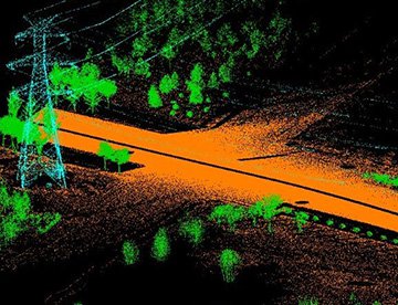
LiDAR Imaging
Light Detection and Ranging, or LiDAR, is a remote sensing method used to examine and measure California topography as well as objects, like vegetation, upon it.
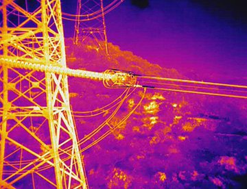
Infrared Imaging
Thermographic IR cameras are used to detect radiation in the long-infrared range of the electromagnetic spectrum and produce images of that radiation, called thermograms.
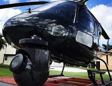
HD Video Gimbal Capture
Modern HD and 4K cameras can be mounted to helicopters, using the proper STCs, with a gimbal to stabilize photos & videos for detailed results.
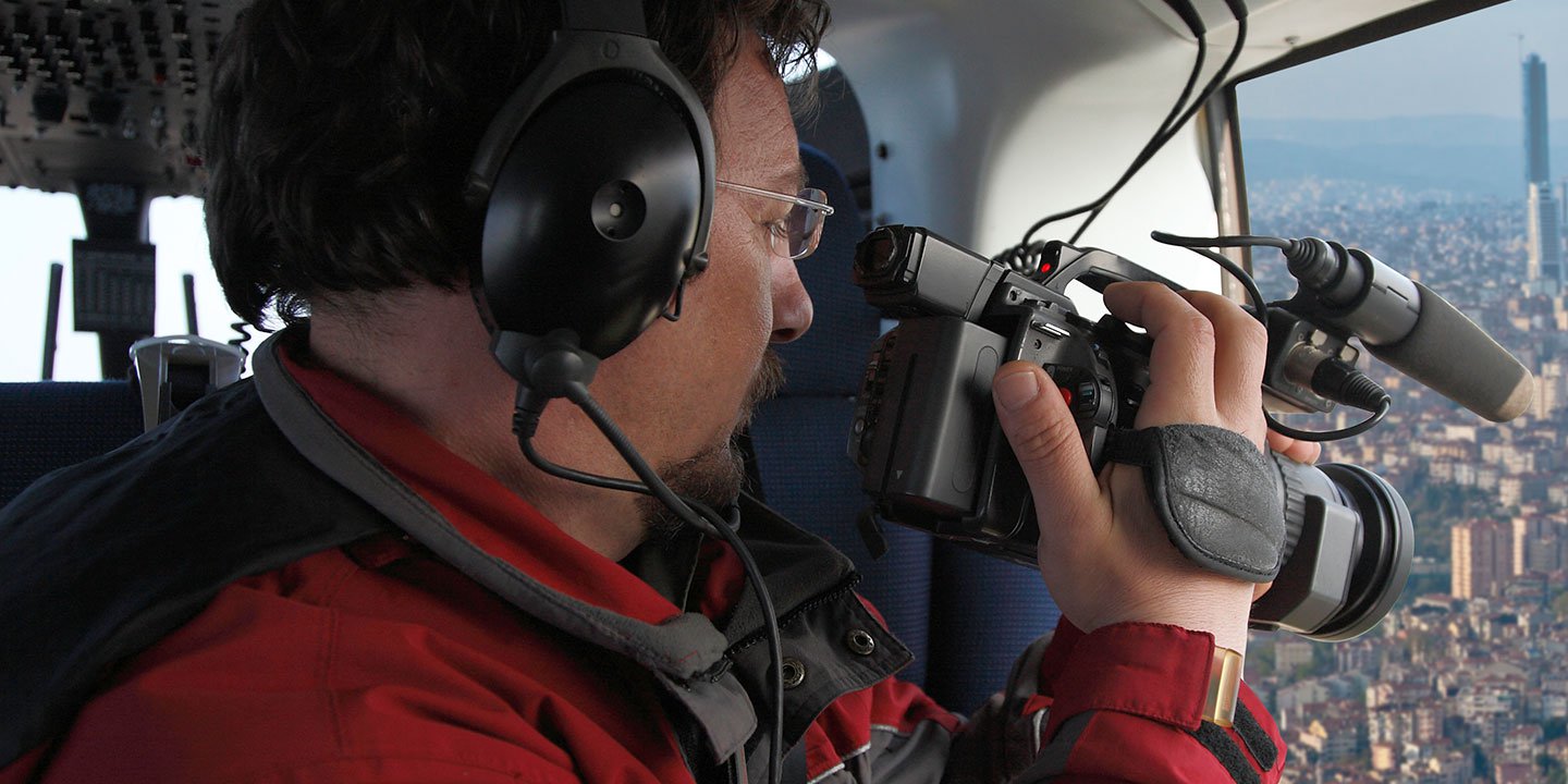
Cutting-Edge Aerial Cinematography for Productions
For expert camera work in the Sacramento Sky
Get a Fast, free QuoteSacramento Aerial Cinematography
Sacramento Helicopter Charters provides comprehensive access to professional-grade aerial cinematography capabilities throughout California. We facilitate custom shoots utilizing the industry's most advanced gyro-stabilized camera mounts, including Tyler Mounts, Wesscam, Cineflex, Pictorvision, and SpaceCam systems, seamlessly integrated with high-end specialty cameras such as Cineflex HD, RED Epic, Arri Alexa, and even cutting-edge 3D or experimental camera technologies. Whether your production demands dynamic air-to-air sequences or precise ground-to-air perspectives, we support every facet of your cinematic vision. Our operational teams are adept at collaborating closely with aerial Directors of Photography and production directors, ensuring the precise execution required to achieve your desired visual narrative. Specializing in helicopter support for both still and motion photography, Sacramento Helicopter Charters is equipped to facilitate nearly every media-related operation across California, encompassing major film and television productions, documentary fieldwork in the Sierra Nevada, impactful promotional videos, commercials, aerial prop deployment, and critical coverage for historical events and major sporting spectacles throughout the Golden State.
Call Us Today at 1-866-826-4826 for a Free Quote
Contact Us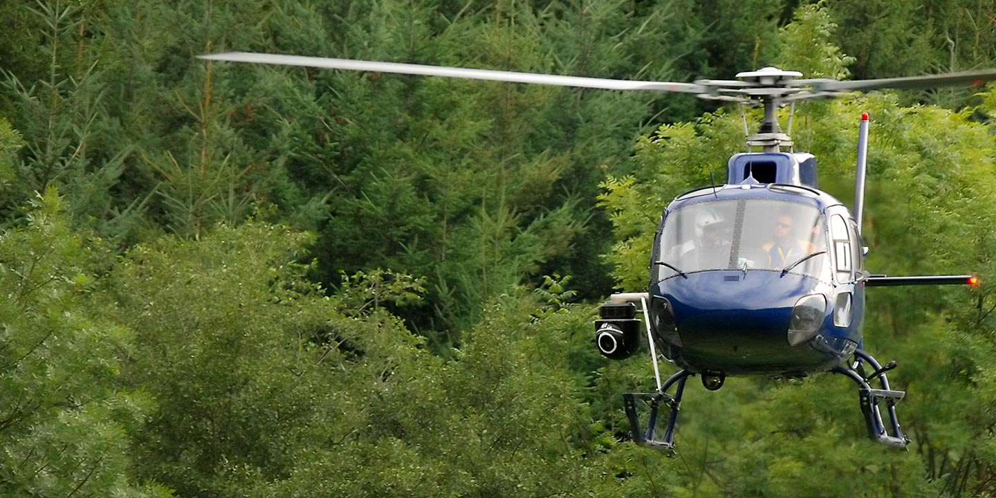
Aerial Photos
Hand-held or Mounted OpTions in Sacramento
We will help you get the right equipment for your aerial photography project! Call 1-866-826-4826 today to get a fast, free quote.
The Most Options for Photography
California’s unparalleled landscapes and iconic landmarks, from the dramatic coastline to the majestic peaks of the Sierra Nevada, are best immortalized from an aerial perspective. Sacramento Helicopter Charters provides specialized aerial photography charters meticulously designed to translate your creative vision into stunning imagery. We facilitate precise shots with options for door-off configurations for handheld precision work, and for projects demanding superior stability, advanced gyro-stabilized camera mounts are available upon request. Our commitment to delivering exceptional photographic opportunities ensures that professional photographers and visual artists can access cost-effective and highly effective solutions for capturing breathtaking views across the Golden State with unmatched clarity and impact.
Superior Service
Every one of our customers gets a dedicated helicopter expert to assist with flight plans, tech loadouts, production logistics, project schedules, and other demands.
Over 500 Aircraft
Our network of direct air partners extends well beyond Sacramento, California. This allows us to offer a wide range of solutions for even the most sophisticated projects.
The Best Equipment
From high-tech sensors like LiDAR, FLIR, and GIS to HD cameras and movie production gimbals, we're here to make your job as easy as possible.


